ʻEua Airport
Appearance
(Redirected from 'Eua Airport)
Eua Airport Kaufana Airport | |||||||||||
|---|---|---|---|---|---|---|---|---|---|---|---|
| Summary | |||||||||||
| Airport type | Public | ||||||||||
| Operator | Ministry of Civil Aviation | ||||||||||
| Serves | ʻEua, Tonga | ||||||||||
| Location | ʻ Mua | ||||||||||
| Elevation AMSL | 325 ft / 99 m | ||||||||||
| Coordinates | 21°22′38″S 174°57′28″W / 21.37722°S 174.95778°W | ||||||||||
| Website | www.TongaAirports.com | ||||||||||
| Map | |||||||||||
 | |||||||||||
| Runways | |||||||||||
| |||||||||||
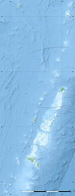
Eua Airport (IATA: EUA, ICAO: NFTE),[3] known in Tonga as Kaufana Airport, is an airport in ʻEua, Tonga. The airport is located 3 km (1.9 mi) southeast of the capital 'Ohonua. The airfield is an unsealed coral strip.[4]
Airlines and destinations
[edit]Passenger
[edit]| Airlines | Destinations |
|---|---|
| Lulutai Airlines | Nuku'alofa[5] |
References
[edit]- ^ "PilotWeb NOTAM". FAA. Archived from the original on 2016-03-05. Retrieved 15 February 2012.
- ^ Airport information for EUA at Great Circle Mapper.
- ^ "Eua, Kaufana (EUA) - Airport details". TheAirDB. Retrieved 7 November 2010.
- ^ "'Eua airport". Tonga Airports Limited. Archived from the original on 26 March 2012. Retrieved 2 July 2011.
- ^ "Tonga Airline never grounded, despite one plane experiencing problems". Radio New Zealand. 13 July 2023.

