Feleacu
Appearance
(Redirected from Gheorghieni)
Feleacu
Erdőfelek | |
|---|---|
 Orthodox church in Vâlcele | |
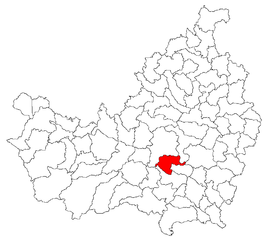
 Location in Cluj County | |
| Coordinates: 46°42′58″N 23°37′06″E / 46.71611°N 23.61833°E | |
| Country | Romania |
| County | Cluj |
| Established | 1366 |
| Subdivisions | Feleacu, Gheorghieni, Vâlcele, Sărădiș, Casele Micești |
| Government | |
| • Mayor (2020–2024) | Gabriel Victor Costea[1] (PNL) |
Area | 61.7 km2 (23.8 sq mi) |
| Elevation | 711 m (2,333 ft) |
| Population (2021-12-01)[2] | 5,693 |
| • Density | 92/km2 (240/sq mi) |
| Time zone | EET/EEST (UTC+2/+3) |
| Postal code | 407270 |
| Area code | +40 x64[3] |
| Vehicle reg. | CJ |
| Website | www |
Feleacu (Hungarian: Erdőfelek; German: Fleck) is a commune in Cluj County, Transylvania, Romania. It is composed of five villages: Casele Micești (Kaszoly), Feleacu, Gheorghieni (Györgyfalva), Sărădiș (Seregélyes), and Vâlcele (Bányabükk).
Demographics
[edit]At the 2021 census, Feleacu had a population of 5,693, [4] an increase from the 2011 census, when the commune had a population of 3,923. Across time, the commune's population has evolved as follows:
| Census[5][6] | Ethnic Composition | |||||||
|---|---|---|---|---|---|---|---|---|
| Year | Population | Romanians | Hungarians | Germans | Roma | Other | ||
| 1850 | 2,049 | 934 | 976 | 3 | 126 | 10 | ||
| 1880 | 2,312 | 943 | 1,158 | 5 | 206 | |||
| 1890 | 4,423 | 2,873 | 1,432 | 5 | 113 | |||
| 1900 | 4,874 | 3,291 | 1,583 | 0 | ||||
| 1910 | 5,604 | 3,632 | 1,958 | 1 | 13 | |||
| 1920 | 5,397 | 3,723 | 1,674 | 0 | ||||
| 1930 | 5,661 | 3,917 | 1,742 | 1 | 1 | |||
| 1941 | 5,699 | 4,104 | 1,571 | 3 | 21 | |||
| 1956 | 5,787 | 4,192 | 1,581 | 14 | 0 | |||
| 1966 | 5,549 | 4,060 | 1,485 | 1 | 3 | |||
| 1977 | 5,883 | 4,363 | 1,516 | 4 | 0 | |||
| 1992 | 4,116 | 2,971 | 1,137 | 8 | 0 | |||
| 2002 | 3,810 | 2,798 | 974 | 34 | 0 | |||
| 2011 | 3,923 | 2,833 | 894 | 99 | ||||
| 2021 | 5,693 | 4,132 | 1,099 | 53 | 404 | |||
Natives
[edit]Ștefan Micle (1820–1879), physicist and chemist
Infrastructure
[edit]- Guyed TV mast for FM-/TV-broadcasting (height: 180 metres (590 ft)) and some lattice towers with directional antennas at 46°42'52"N 23°38'32"E.
Notes
[edit]- ^ "Results of the 2020 local elections". Central Electoral Bureau. Retrieved 11 June 2021.
- ^ "Populaţia rezidentă după grupa de vârstă, pe județe și municipii, orașe, comune, la 1 decembrie 2021" (XLS). National Institute of Statistics.
- ^ x is a digit indicating the operator: 2 for the former national operator, Romtelecom, and 3 for the other ground telephone networks
- ^ "Results of 2021 census". INS. Retrieved 23 December 2023.
- ^ Varga E. Census statistics in Transylvania, 1850-1992
- ^ 2002 census data


