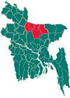
Tarakanda Upazila
Tarakanda
তারাকান্দা | |
|---|---|
 Bandsa River near Tarakanda Bazar | |
 | |
| Coordinates: 24°51′43″N 90°26′24″E / 24.862°N 90.44°E | |
| Country | |
| Division | Mymensingh |
| District | Mymensingh |
| Government | |
| • MP (Mymensingh-2) | Sharif Ahmed (Awami League) |
| • Upazila Chairman | Muhammad Fazlul Haque Majhiyali |
| Area | |
• Total | 313.68 km2 (121.11 sq mi) |
| Population | |
• Total | 337,308 |
| • Density | 1,100/km2 (2,800/sq mi) |
| Time zone | UTC+6 (BST) |
| Postal code | 2252[2] |
| Website | tarakanda |
Tarakanda (Bengali: তারাকান্দা) is an upazila of the Mymensingh District in Bangladesh.[3][4] It lies on the banks of Mara Kharia river.
History
[edit]It is estimated that human habitation in this area began between the sixth and twelfth centuries.
Tarakanda was established as a thana on 19 May 1999. In 2012, the Tarakanda Thana was upgraded into an upazila (sub-district), making it Mymensingh District's latest upazila.[5] Prior to this, Tarakanda was a part of Phulpur Upazila.[6]
Demographics
[edit]According to the 2011 Census of Bangladesh, Tarakanda Upazila had 65,838 households and a population of 298,220, of which 147,742 are males and 150,478 females. 86,889 (29.14%) were under 10 years of age. Tarakanda has a literacy rate (age 7 and over) of 37.27%, compared to the national average of 51.8%, and a sex ratio of 1019 females per 1000 males. The population was entirely rural. Muslims were 284,763 and Hindus 12,696.[8]
Economy and tourism
[edit]The Tarakanda Jami Mosque is a popular mosque. The Tarakanda Bazar is also noted. The Tarakanda Barta, Monthly Kaler Alo, Monthly Nabadiganta and Fortnightly Tarakanda are published here.[6] The economy is mostly agriculturaland the upazila produces a large quantity of fish and vegetables.
Administration
[edit]Tarakanda Upazila is divided into ten union parishads: Balikha, Banihala, Biska, Dhakua, Galagaon, Kakni, Kamargaon, Kamaria, Rampur, and Tarakanda.[9]
Upazila Chairmen
[edit]| Name | Term |
|---|---|
| Sharif Ahmed | 5/11/2013 - 1/12/2013 |
| Shaykh Alauddin | 6/1/2014 - 19/6/2014 |
| Motahar Husayn | 19/6/2014 - 5/11/2018 |
| Muhammad Fazlul Haque | 8/11/2018–present |
Education
[edit]In 1929, the Tarakanda Multilateral High School was established. Other notable institutions include Shahid Smrity High School, Galagaon High School, Kakni High School and Kakni Model Academy.
See also
[edit]References
[edit]- ^ National Report (PDF). Population and Housing Census 2022. Vol. 1. Dhaka: Bangladesh Bureau of Statistics. November 2023. p. 401. ISBN 978-9844752016.
- ^ "Bangladesh Postal Code". Dhaka: Bangladesh Postal Department under the Department of Posts and Telecommunications of the Ministry of Posts, Telecommunications and Information Technology of the People's Republic of Bangladesh. 20 October 2024.
- ^ "upazila List". Bangladesh National Portal.
- ^ "List of Upazila Nirbahi Officers". Ministry of Public Administration. Retrieved 10 January 2019.
- ^ তারাকান্দা উপজেলার পটভূমি [Tarakanda Upazila's background]. Tarakanda Upazila (in Bengali).
- ^ a b Nurul Amin (2012). "Phulpur Upazila". In Sirajul Islam; Miah, Sajahan; Khanam, Mahfuza; Ahmed, Sabbir (eds.). Banglapedia: the National Encyclopedia of Bangladesh (Online ed.). Dhaka, Bangladesh: Banglapedia Trust, Asiatic Society of Bangladesh. ISBN 984-32-0576-6. OCLC 52727562. OL 30677644M. Retrieved 6 January 2025.
- ^ Population and Housing Census 2022 - District Report: Mymensingh (PDF). District Series. Dhaka: Bangladesh Bureau of Statistics. June 2024. ISBN 978-984-475-226-9.
- ^ "Bangladesh Population and Housing Census 2011 Community Report – Mymensingh" (PDF). bbs.gov.bd. Bangladesh Bureau of Statistics.
- ^ তারাকান্দা উপজেলা [List of Unions]. Tarakanda Upazila (in Bengali).

