Daru Airport
Daru Airport | |||||||||||
|---|---|---|---|---|---|---|---|---|---|---|---|
 | |||||||||||
| Summary | |||||||||||
| Airport type | Public | ||||||||||
| Operator | Government | ||||||||||
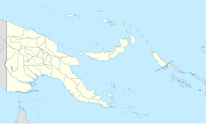
| Serves | Daru, Western Province, Papua New Guinea | ||||||||||
| Elevation AMSL | 6 m / 20 ft | ||||||||||
| Coordinates | 09°05′12″S 143°12′28″E / 9.08667°S 143.20778°E | ||||||||||
| Map | |||||||||||
 | |||||||||||
| Runways | |||||||||||
| |||||||||||
Daru Airport (IATA: DAU, ICAO: AYDU) is an airport serving Daru, the capital of the Western Province in Papua New Guinea.
The airfield was constructed before or during World War II. During the war it was used as a refuelling stop by Allied fighter aircraft. The Australian Army rebuilt the airport in 1965.[4] Domestically, airport is served by PNG Air and Air Niugini with access to destinations including the national capital, Port Moresby. Internationally, Torres Strait Air operates flights to Horn Island, the primary airport serving in the Torres Strait Islands of Queensland, Australia.[5]
Airlines and destinations
[edit]| Airlines | Destinations |
|---|---|
| Air Niugini | Port Moresby |
| PNG Air | Awaba, Balimo, Kiunga, Port Moresby, Sasereme, Suki |
| Torres Strait Air | Charter: Horn Island[5]
|
There was a new international flight when Air Niugini open a new route to Merauke (Mopah Airport) in 1989, it was the first airport to open the international flight, and it was terminated from 1997.
References
[edit]- ^ "Airport information for AYDU". World Aero Data. Archived from the original on 2019-03-05. Data current as of October 2006. Source: DAFIF.
- ^ Airport information for DAU at Great Circle Mapper. Source: DAFIF (effective October 2006).
- ^ Airport information for Daru Airport at Transport Search website.
- ^ "Daru Airfield Western Province (Fly) Papua New Guinea (PNG)". Pacific Wrecks. Retrieved 5 February 2021.
- ^ a b https://www.queensland.com/au/en/plan-your-holiday/transport/p-5f83c79c94949d35084ffb68-torres-strait-air
External links
[edit]

