Gaziemir Air Base
Appearance
Gaziemir Air Base Gaziemir Hava Üssü | |||||||||||
|---|---|---|---|---|---|---|---|---|---|---|---|
| Summary | |||||||||||
| Airport type | Military | ||||||||||
| Owner | Turkish Air Force | ||||||||||
| Operator | Air Force Training Command | ||||||||||
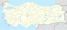
| Location | İzmir, Turkey | ||||||||||
| Elevation AMSL | 132 m / 433 ft | ||||||||||
| Coordinates | 38°19′08.78″N 27°09′33.67″E / 38.3191056°N 27.1593528°E | ||||||||||
| Map | |||||||||||
 | |||||||||||
| Runways | |||||||||||
| |||||||||||
Gaziemir Air Base (Turkish: Gaziemir Hava Üssü, ICAO: LTBK) is an airbase of the Turkish Air Force 10 km (6.2 mi) south of İzmir, Turkey. It is owned by the Turkish Air Force and operated by the Air Force Training Command.[2]
The airport is at an elevation of 132 m (433 ft) above mean sea level. It has one runway in north–south direction, designated 17/35, with an asphalt surface measuring 1,357 m (4,452 ft).[1]
The air base is the headquarters of the Air Force Training Command and hosts the training wing's 203rd Search and Rescue Squadron (Ege) with its CASA CN-235M-100 aircraft.[2]
The foreign-language school (Turkish: Hava Lisan Okulu Komutanlığı) of the Air Force is at the Gaziemir Air Base.[3]
References
[edit]- ^ a b "Airport information for LTBK". World Aero Data. Archived from the original on 2019-03-05. Data current as of October 2006. Source: DAFIF.
- ^ a b "Izmir Gaziemir". Scramble. Archived from the original on 2010-10-03. Retrieved 2010-10-03.
- ^ "站长素材-分享综合设计素材的平台". www.askerinyeri.com. Archived from the original on September 3, 2010.

