Ilam County
Ilam County
Persian: شهرستان ایلام | |
|---|---|
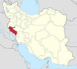
 Location of Ilam County in Ilam province (top left, green) | |
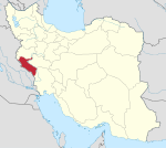
 Location of Ilam Province in Iran | |
| Coordinates: 33°34′N 46°27′E / 33.567°N 46.450°E[1] | |
| Country | Iran |
| Province | Ilam |
| Capital | Ilam |
| Districts | Central, Sivan |
| Population (2016)[2] | |
• Total | 235,144 |
| Time zone | UTC+3:30 (IRST) |
| Ilam County can be found at GEOnet Names Server, at this link, by opening the Advanced Search box, entering "9205930" in the "Unique Feature Id" form, and clicking on "Search Database". | |
Ilam County (Persian: شهرستان ایلام) is in Ilam Province, Iran. Its capital is the city of Ilam.[3]
History
[edit]After the 2011 National Census, Keshvari Rural District was created in the Central District, and Mish Khas Rural District was separated from it in the formation of Sivan District, including the new Alishervan Rural District.[4]
In 2019, the village of Jafarabad was elevated to the status of a city.[5] Chavar District was separated from the county in the establishment of Chavar County.[6]
In 2023, Mahmudabad Rural District was created in Sivan District, and Alishervan Rural District was separated from it to join Badreh County.[7]
Demographics
[edit]Population
[edit]At the time of the 2006 census, the county's population was 193,222 in 42,207 households.[8] The following census in 2011 counted 213,579 people in 52,391 households.[9] The 2016 census measured the population of the county as 235,144 in 64,671 households.[2]
Administrative divisions
[edit]Ilam County's population history and administrative structure over three consecutive censuses are shown in the following table.
| Administrative Divisions | 2006[8] | 2011[9] | 2016[2] |
|---|---|---|---|
| Central District | 181,362 | 201,523 | 215,543 |
| Deh Pain RD | 16,909 | 19,898 | 13,726 |
| Keshvari RD | 7,787 | ||
| Mishkhas RD | 9,164 | 9,412 | |
| Ilam (city) | 155,289 | 172,213 | 194,030 |
| Chavar District[a] | 11,860 | 11,710 | 10,554 |
| Arkavazi RD | 4,640 | 4,384 | 3,702 |
| Buli RD | 1,646 | 1,551 | 1,021 |
| Chavar (city) | 5,574 | 5,775 | 5,831 |
| Sivan District | 8,994 | ||
| Alishervan RD[b] | 1,767 | ||
| Mahmudabad RD[c] | |||
| Mish Khas RD | 7,227 | ||
| Jafarabad (city)[d] | |||
| Total | 193,222 | 213,579 | 235,144 |
| RD = Rural District | |||
See also
[edit]![]() Media related to Ilam County at Wikimedia Commons
Media related to Ilam County at Wikimedia Commons
Notes
[edit]- ^ Transferred to Chavar County after the 2016 census[6]
- ^ Transferred to Badreh County after the 2016 census[7]
- ^ Established after the 2016 census[7]
- ^ Became a city after the 2016 census[5]
References
[edit]- ^ OpenStreetMap contributors (23 November 2024). "Ilam County" (Map). OpenStreetMap (in Persian). Retrieved 23 November 2024.
- ^ a b c Census of the Islamic Republic of Iran, 1395 (2016): Ilam Province. amar.org.ir (Report) (in Persian). The Statistical Center of Iran. Archived from the original (Excel) on 1 November 2020. Retrieved 19 December 2022.
- ^ Habibi, Hassan (c. 2024) [Approved 21 June 1369]. Approval of the organization and chain of citizenship of the elements and units of the national divisions of Ilam province, centered in the city of Ilam. lamtakam.com (Report) (in Persian). Ministry of the Interior, Defense Political Commission of the Government Council. Proposal 3233.1.5.53; Letter 93808-907; Notification 83348/T132K. Archived from the original on 8 February 2024. Retrieved 8 February 2024 – via Lam ta Kam.
- ^ Rahimi, Mohammad Reza (c. 2013) [Approved 14 December 2013]. Approval letter regarding the national divisions of Ilam province. rc.majlis.ir (Report) (in Persian). Ministry of the Interior, Political and Defense Commission. Proposals 89421/42/1/1 and 135295/42/4/1; Letter 158802/T38854H. Archived from the original on 23 August 2013. Retrieved 7 June 2023 – via Islamic Parliament Research Center of the Islamic Republic of Iran.
- ^ a b "The approval of the Minister of the Interior with the establishment of Jafarabad municipality in Ilam province". borna.news (in Persian). Ministry of the Interior. 26 August 2019. Archived from the original on 12 November 2023. Retrieved 12 November 2023.
- ^ a b Jahangiri, Ishaq (c. 2022) [Approved 8 November 2019]. Letter of approval regarding national divisions in Ilam County, Ilam province. qavanin.ir (Report) (in Persian). Ministry of the Interior, Council of Ministers. Proposal 216963. Archived from the original on 17 November 2022. Retrieved 4 June 2023 – via Laws and Regulations Portal of the Islamic Republic of Iran.
- ^ a b c Mokhbar, Mohammad (5 April 2023) [Approved 24 December 1401]. Letter of approval regarding the national divisions of Ilam province (PDF). rrk.ir (Report) (in Persian). Ministry of the Interior, Board of Ministers. Proposal 208825; Notification 242454/T58629H. Archived from the original (PDF) on 21 April 2023. Retrieved 12 November 2023.
- ^ a b Census of the Islamic Republic of Iran, 1385 (2006): Ilam Province. amar.org.ir (Report) (in Persian). The Statistical Center of Iran. Archived from the original (Excel) on 20 September 2011. Retrieved 25 September 2022.
- ^ a b Census of the Islamic Republic of Iran, 1390 (2011): Ilam Province. irandataportal.syr.edu (Report) (in Persian). The Statistical Center of Iran. Archived from the original (Excel) on 17 January 2023. Retrieved 19 December 2022 – via Iran Data Portal, Syracuse University.

