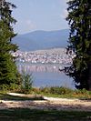
Krastava, Pazardzhik Province
Appearance
Krastava
Кръстава | |
|---|---|
Village | |
 | |
| Coordinates: 41°57′35.61″N 23°49′14.8″E / 41.9598917°N 23.820778°E | |
| Government | |
| • Mayor | Salih Uzunov (GERB) |
| Area | |
• Total | 159.748 km2 (61.679 sq mi) |
| Population | |
• Total | 1,034 |
| • Density | 6.5/km2 (17/sq mi) |
| Time zone | UTC+2 (EET) |
| • Summer (DST) | UTC+2 (EEST) |
Krastava (Bulgarian: Кръстава) is a village located in Velingrad Municipality, Pazardzhik Province, Southern Bulgaria.[1]
The village of Krastava is located in a mountainous area, 26 km from Velingrad. It is a mountainous area composed mainly of pine and spruce forests. From the vicinity of the village three mountains can be seen - Rila, Pirin, Rhodope Mountains, as well as the peaks Musala, Vihren, Golyama Syutka and Malka Syutka.
History
[edit]Krastava was established as a settlement in 1790.[2] The first school was established in 1926.[3] As a village, it was established on 24 October 1975. In 1978, the mahallas Goritsa (Asanova) and Krantiyte were incorporated into Krastava and had its own mayoralty in 1979.[2]
Religion
[edit]Krastava is a Pomak village.
References
[edit]- ^ "*** Guide Bulgaria *** - Village Krastava". Guide Bulgaria. Retrieved 2023-01-23.
- ^ a b "Локация: Кръстава – Калята и прокълната пещера пълна със злато | PZdnes | Днес новината си ти" (in Bulgarian). Retrieved 2023-01-23.
- ^ "ОБЕДИНЕНО УЧИЛИЩЕ ВАСИЛ ЛЕВСКИ, Село Кръстава". registarnauchilishtata.com. Retrieved 2023-01-23.


