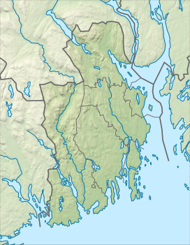
Lauvkollen
Appearance
| Lauvkollen | |
|---|---|
| Highest point | |
| Elevation | 516 m (1,693 ft)[2] |
| Prominence | 67 m (220 ft)[2] |
| Isolation | 1.2 km (0.75 mi)[2] |
| Coordinates | 59°39′04″N 10°05′46″E / 59.65112°N 10.09615°E[1] |
| Geography | |
| Location | Vestfold and Buskerud, Norway |
Lauvkollen is a mountain on the border of Holmestrand Municipality in Vestfold county and Drammen Municipality in Buskerud county, Norway. The 516-metre (1,693 ft) tall mountain is located about 10 kilometres (6.2 mi) northwest of the village of Sande and about 8 kilometres (5.0 mi) southwest of the village of Skoger.[2]
See also
[edit]References
[edit]- ^ "Lauvkollen" (in Norwegian). yr.no. Retrieved 18 March 2024.
- ^ a b c d "Lauvkollen". PeakVisor.com. Retrieved 18 March 2024.
External links
[edit]


