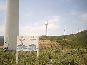
Lori 1 Wind Farm
Appearance
| Lori 1 Wind Farm | |
|---|---|
 The Lori 1 Wind Power plant at Pushkin Pass | |
 | |
| Country | |
| Location | Lori Province |
| Coordinates | 40°54′41.36″N 44°25′52.86″E / 40.9114889°N 44.4313500°E |
| Status | Operational |
| Commission date | 2005 |
| Construction cost | US$3.2 million |
| Owner | High-Voltage Electric Networks of Armenia |
| Wind farm | |
| Type | Onshore |
| Power generation | |
| Units operational | 4 x 660 kW |
| Nameplate capacity | 2.6 MW Planned: 90 MW |
| External links | |
| Commons | Related media on Commons |
Lori 1 Wind Farm is a wind farm in Armenia located along the Bazum Mountains at Pushkin Pass in Lori, Armenia. The first wind farm in the country, it has four 660-kW wind turbines and has a capacity of 2.64 MWe.[1] Completed in December 2005 by the Iranian company Sunir with US$3.2 million funding from Iran, it is owned by the High-Voltage Electric Networks of Armenia.[1] In 2006, Lori 1 generated only 2.6 GWh of electricity (a yearly average of 296.8 KWe—about 11% of installed capacity).[2]
The Armenian and Iranian authorities have agreed to expand the wind farm up to 90 MW.[3]
References
[edit]- ^ a b "Wind energy in Armenia: overview of potential and development perspectives" (PDF). US AID. March 2010. Archived from the original (PDF) on 2012-06-19. Retrieved 2012-12-23.
- ^ PSRC-Q42006-Energy-Main-Indicators Archived 2011-05-31 at the Wayback Machine, Public Services Regulatory Commission of Armenia, 2007.]
- ^ Iran-Armenia Wind Farm
Wikimedia Commons has media related to Lori 1 Wind Farm.
