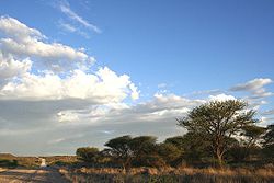
Plooysburg
Appearance
Plooysburg | |
|---|---|
 Plooysburg | |
| Coordinates: 29°01′S 24°14′E / 29.017°S 24.233°E | |
| Country | South Africa |
| Province | Northern Cape |
| District | Pixley ka Seme |
| Municipality | Siyancuma |
| Population | |
• Total | 594 |
| Time zone | UTC+2 (SAST) |
| PO box | 8350 |
| Area code | 053 |
Plooysburg is a small town about 70 km west of Kimberley, Northern Cape, South Africa. It is situated close to the Riet River. The town took its name from the Du Plooy family, one of the original famlies of white selttlers.[2] With a church, school, police station and shop it serves a local farming and farm-worker community. Nearby is the rock art site of Driekops Eiland, and the Mokala National Park.[3]
References
[edit]- ^ Water Services National Information System - Community Report
- ^ Morris, David (October 2002). "Driekopseiland and 'the rain's magic power': landscape and history in a new interpretation of a Northern Cape rock engraving site" (PDF). CORE. p. 141. Retrieved 18 November 2024.
- ^ Morris, D. 2002. Driekopseiland and 'the rain's magic power': landscape and history in a new interpretation of a Northern Cape rock engraving site. MA dissertation, Dept Anthropology and Sociology, University of the Western Cape


