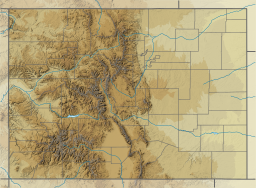
Sanchez Reservoir
Appearance
| Sanchez Reservoir | |
|---|---|
 Looking south across the reservoir. | |
| Location | Costilla County, Colorado |
| Coordinates | 37°05′02″N 105°24′52″W / 37.08389°N 105.41444°W |
| Type | reservoir |
| Primary inflows | Ventero Creek Sanchez Canal |
| Basin countries | United States |
| Managing agency | Sanchez Ditch and Reservoir Company |
| Designation | Sanchez Reservoir State Wildlife Area |
| Built | 1912 |
| First flooded | 1912 |
| Surface area | 3,145 acres (1,273 hectares) |
| Water volume | 103,000 acre-feet (127,000,000 cubic meters) |
| Surface elevation | 2,518 meters (8,261 feet) [1] |
Sanchez Reservoir lies in far southcentral Colorado, west of the Sangre de Cristo Mountains in Costilla County. Its inflows include Ventero Creek and the Sanchez Canal, a diversion canal that takes water from Culebra Creek and two other creeks.[2]
Dam
[edit]The reservoir's earthen dam was built in 1912. Because the dam leaks a lot and because of ongoing drought in the region, the reservoir never really reaches its full capacity.[3]
Fishing
[edit]Colorado Parks and Wildlife manages fishing at the reservoir, which forms the Sanchez Reservoir State Wildlife Area. However, the Colorado Department of Public Health and Environment has issued a "Fish consumption advisory," warning of unsafe mercury levels in northern pike and walleye caught in the lake.[4]
References
[edit]- ^ "Sanchez Reservoir". Geographic Names Information System. United States Geological Survey, United States Department of the Interior.
- ^ "Total maximum daily load for Mercury in Sanchez Reservoir, Colorado". Colorado Department of Public Health and Environment. Retrieved April 16, 2018.
- ^ "Evidence in Support of a Change in Aquatic Life Use Sub-Classification" (PDF). Colorado Department of Public Health and Environment. Water Quality Control Division. June 1, 2013. Retrieved April 16, 2018.
- ^ "Sanchez Reservoir fish consumption advisory" (PDF). Colorado Department of Public Health and Environment. Retrieved April 16, 2018.
External links
[edit]

