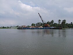
Thủ Đức (urban district)
Thủ Đức district
Quận Thủ Đức | |
|---|---|
 Trường Thọ, Thủ Đức | |
 Position in HCMC's core | |
| Coordinates: 10°48′10″N 106°41′41″E / 10.80278°N 106.69472°E | |
| Country | Vietnam |
| Centrally governed city | Hồ Chí Minh City |
| Seat | 43 Nguyễn Văn Bá |
| Wards | 12 phường |
| Area | |
• Total | 47.76 km2 (18.44 sq mi) |
| Population (2018) | |
• Total | 524,670 |
| • Density | 11,000/km2 (28,000/sq mi) |
| Demographics | |
| • Main ethnic groups | predominantly Kinh |
| Time zone | UTC+07 (ICT) |
| Website | thuduc |
Thủ Đức is a former urban district (quận) in the northeast of Hồ Chí Minh City, Vietnam. In 1997, the southern part of Thủ Đức was divided to become District 2 and District 9. In 2010, the district had a population of 455,899.[1] It covered an area of 48 km2.[1]
Thủ Đức district was merged with District 2 and District 9 again to become Thủ Đức City in January 2021, by Standing Committee of the National Assembly's approval.[2]
Location within Ho Chi Minh City
[edit]Administration
[edit]Thủ Đức district consists of 12 wards: Linh Đông, Linh Tây, Linh Chiểu, Linh Trung, Linh Xuân, Hiệp Bình Chánh, Hiệp Bình Phước, Tam Phú, Trường Thọ, Bình Chiểu, Bình Thọ and Tam Bình.
Amenities
[edit]Thủ Đức district hosted the Saigon Water Park which has now closed. It was the location of Thủ Đức Military Academy.
Education
[edit]It is the location of Vietnam National University, Ho Chi Minh City.
References
[edit]- ^ a b "HCMC's Population and population density in 2010 by district". HCMC Office of Statistics. Retrieved February 4, 2014.
- ^ Đoàn Loan, Viết Tuân (December 9, 2020). "Establishment of Thủ Đức City (in Vietnamese)". VnExpress.


