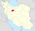
Verjan
Appearance
Verjan
Persian: ورجان | |
|---|---|
Village | |
| Coordinates: 34°26′07″N 50°52′47″E / 34.43528°N 50.87972°E[1] | |
| Country | Iran |
| Province | Qom |
| County | Kahak |
| District | Central |
| Rural District | Kahak |
| Population (2016)[2] | |
• Total | 1,024 |
| Time zone | UTC+3:30 (IRST) |
Verjan (Persian: ورجان)[a] is a village and the capital of Kahak Rural District of the Central District[b] of Kahak County, Qom province, Iran.[6] The rural district was previously administered from the city of Kahak.[7][c]
Demographics
[edit]Population
[edit]At the time of the 2006 National Census, the village's population was 763 in 226 households, when it was in Qom County.[9] The following census in 2011 counted 1,029 people in 321 households.[10] The 2016 census measured the population of the village as 1,024 people in 327 households.[2]
After the census, the district was separated from the county in the establishment of Kahak County and renamed the Central District.[6]
See also
[edit]Notes
[edit]- ^ Also romanized as Varjān and Verjān; also known as Vīrjān[3]
- ^ Formerly Nofel Loshato District,[4] renamed Kahak District,[5] and again renamed the Central District of Kahak County[6]
- ^ Formerly Nofel Loshato,[4] renamed Kahak[8]
References
[edit]- ^ OpenStreetMap contributors (6 January 2025). "Verjan, Kahak County" (Map). OpenStreetMap (in Persian). Retrieved 6 January 2025.
- ^ a b Census of the Islamic Republic of Iran, 1395 (2016): Qom Province. amar.org.ir (Report) (in Persian). The Statistical Center of Iran. Archived from the original (Excel) on 11 January 2021. Retrieved 19 December 2022.
- ^ Verjan can be found at GEOnet Names Server, at this link, by opening the Advanced Search box, entering "-3088187" in the "Unique Feature Id" form, and clicking on "Search Database".
- ^ a b Bazargan, Mehdi (c. 2024) [Approved 2 July 1358]. Changing the name of the district and the center of the district of Kahak from the functions of Qom city to Nofel Lochato. lamtakam.com (Report) (in Persian). Council of Ministers of the Provisional Government of the Islamic Republic of Iran. Proposal 8157.53. Archived from the original on 7 October 2024. Retrieved 6 January 2025 – via Lam ta Kam.
- ^ "Approval of the reform of national divisions in nine provinces of the country". dolat.ir (in Persian). Ministry of the Interior, Cabinet of Ministers. 9 April 2019 [Approved 22 December 1397]. Proposal 158389. Archived from the original on 15 June 2019. Retrieved 29 December 2024 – via Secretariat of the Government Information Council.
- ^ a b c Jahangiri, Ishaq (c. 2022) [Approved 15 February 1400]. Letter of approval regarding the national divisions of Kahak District in Qom province. qavanin.ir (Report) (in Persian). Ministry of the Interior, Council of Ministers. Proposal 206826. Archived from the original on 19 October 2022. Retrieved 12 May 2023 – via Laws and Regulations Portal of the Islamic Republic of Iran.
- ^ Mousavi, Mirhossein (c. 2024) [Approved 2 February 1366]. Creation and formation of nine rural districts including villages, farms and places in Qom County under Tehran province. lamtakam.com (Report) (in Persian). Ministry of the Interior, Council of Ministers. Proposal 11955.1.5.53. Archived from the original on 9 January 2024. Retrieved 9 January 2024 – via Lam ta Kam.
- ^ "'Nofel Lochato' Ruby in Qom". borna.news (in Persian). 4 December 2015. Archived from the original on 6 January 2025. Retrieved 6 January 2025 – via Borna News Agency.
- ^ Census of the Islamic Republic of Iran, 1385 (2006): Qom Province. amar.org.ir (Report) (in Persian). The Statistical Center of Iran. Archived from the original (Excel) on 20 September 2011. Retrieved 25 September 2022.
- ^ Census of the Islamic Republic of Iran, 1390 (2011): Qom Province. irandataportal.syr.edu (Report) (in Persian). The Statistical Center of Iran. Archived from the original (Excel) on 20 January 2023. Retrieved 19 December 2022 – via Iran Data Portal, Syracuse University.


